See It In Action
Real results from AfriScan — AI detection on satellite and drone imagery across Mozambique.
 AI DETECTION — LIVE
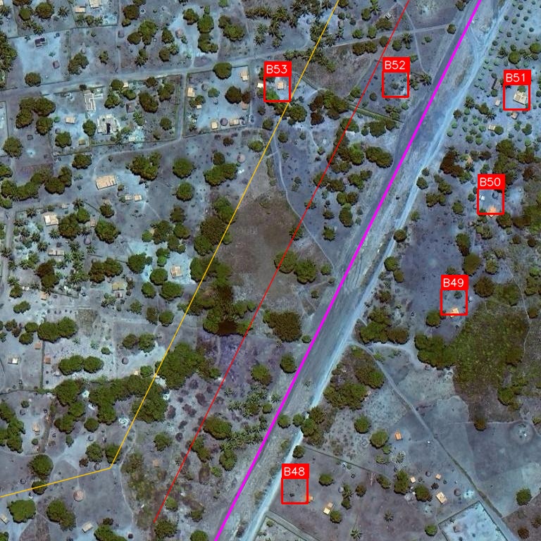
Pipeline Corridor — Live Detection
6 buildings identified along a pipeline corridor with buffer zone overlays. Each structure labelled with a unique ID, GPS coordinates, and distance to pipeline — ready for the risk report.
 AI DETECTION
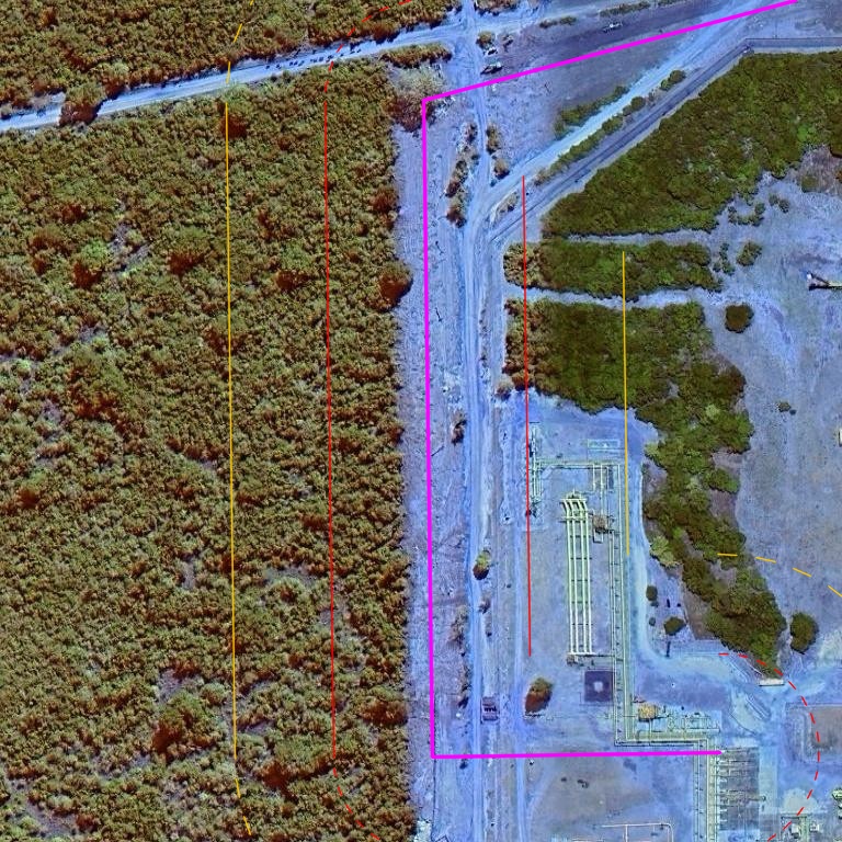
Industrial Encroachment
Industrial facility flagged within the pipeline buffer zone. AfriScan detects structures of all sizes — from mud huts to processing plants — and classifies risk by proximity to the corridor.
 AI DETECTION
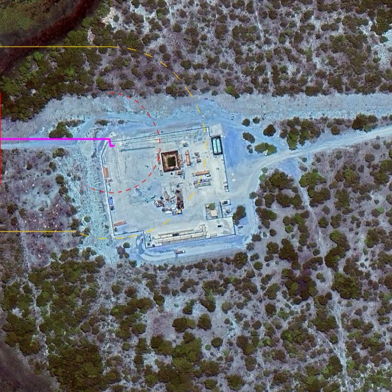
Facility Detection in Bush Terrain
Fenced compound identified adjacent to the pipeline route in dense Mozambique bush. Corridor buffer zones (50m red, 100m orange) pinpoint exactly how close infrastructure sits to the pipeline.
 AI DETECTION
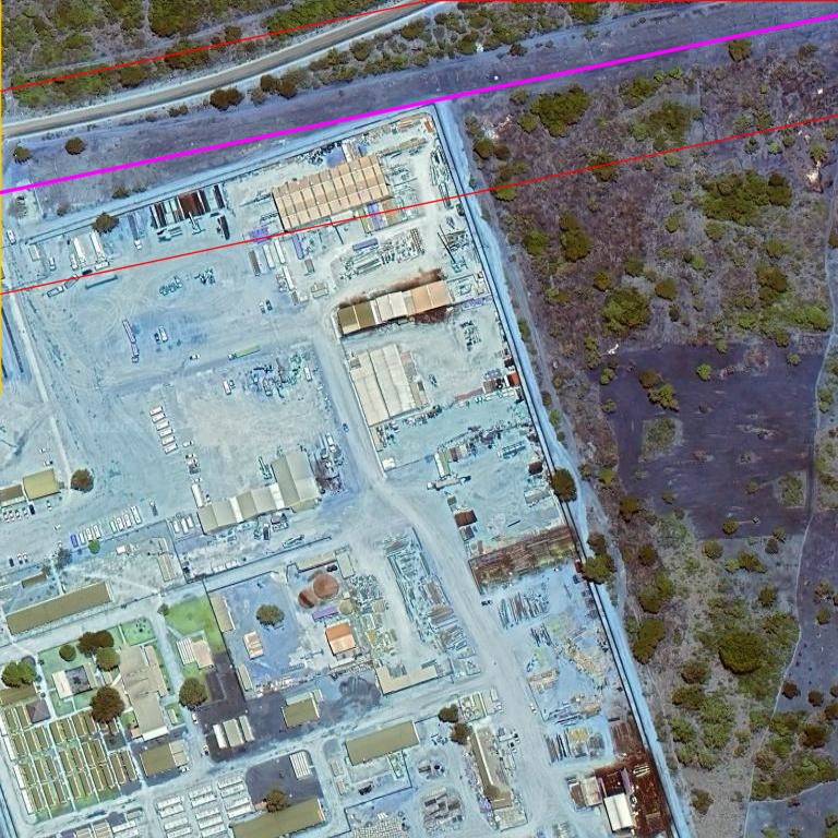
Full Corridor Scan
An entire pipeline corridor scanned in minutes. Every building and facility within the buffer zone is identified, measured, and included in the professional risk report.
 CHANGE DETECTION
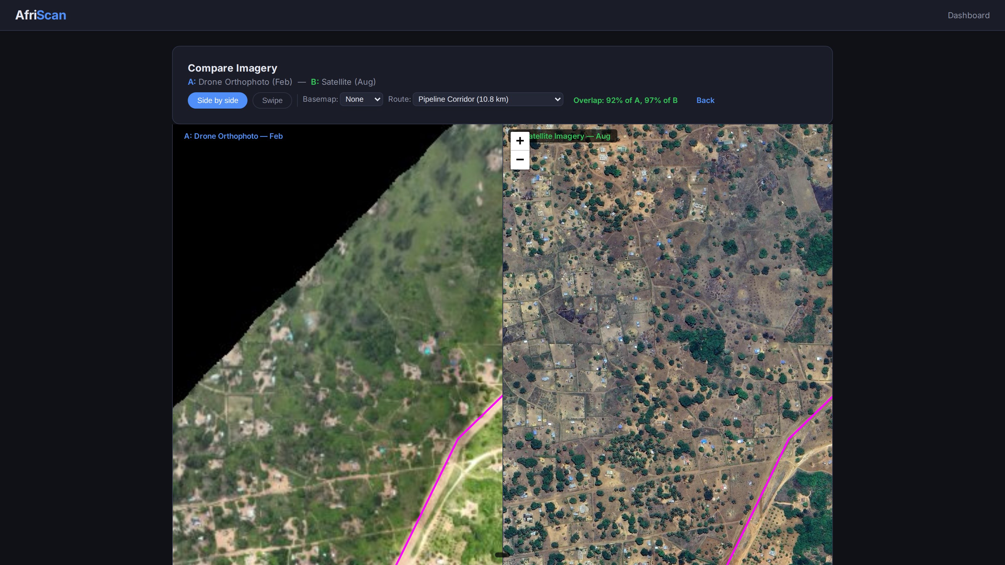
Historical Imagery Comparison
Side-by-side view of a pipeline corridor — drone orthophoto (left) and high-resolution satellite (right) with the route overlaid in magenta. Spot new buildings, cleared land, and encroachment between surveys at a glance.